Camp Pit River
General Info
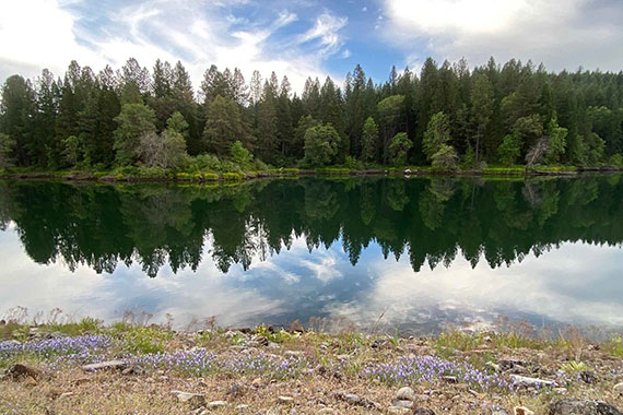
Camp Pit River, in the Mt. Shasta region, is PSEA’s most remote camp with the nearest town of Burney about 35 miles away. Here at 2,000 feet elevation, the days are warm, and nights are cool.
The area is well known for superior hunting and fishing. The cold, spring-fed waters of the Pit River provide an excellent home for trout but if you prefer to fish by boat there is a ramp at Iron Canyon Reservoir, about 20 minutes from camp.
Throughout the area, photography buffs can capture brilliant spring wildflowers or vivid fall colors, and hikers can enjoy the natural beauty and wildlife along wooded trails.
FISH WEEK SPECIALS (flyer)
Saturday, April 20 – Saturday, May 4, 2024
Saturday, September 14 – Saturday, September 28, 2024
DOG WEEK (flyer)
Saturday, October 12 – Saturday, October 19
IMPORTANT: All access to the waterfall and fall’s pool area at McArthur Burney Falls MSP will be closed due to reconstruction of the main trail starting in early April through the entire 2024 season. Additionally, CalTrans will be preforming a major Highway 89 rehabilitation project during the same period which will significantly add traffic congestion, delays and intermittent traffic closures near the park entrance.
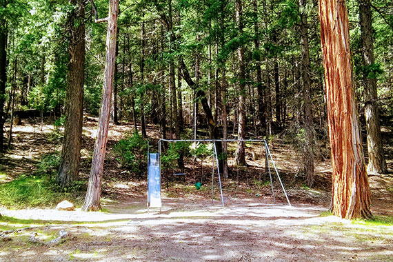
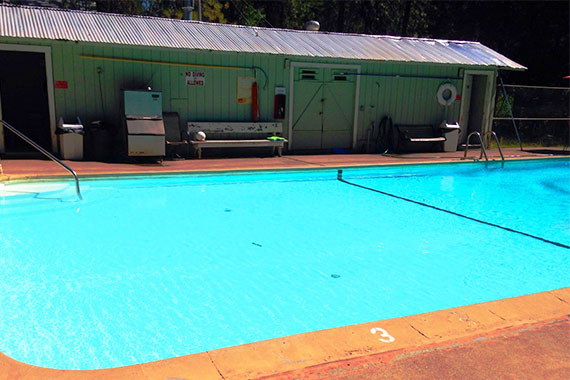
Camp Features
- Heated swimming pool and wading pool in peak season
- Playground
- Laundry facilities
- Wi-fi (limited)
- Barbecues (charcoal not provided)
- Ice machine
The camp is somewhat isolated, so it is advisable to bring several days worth of provisions. There is a general store with limited grocery supplies in Big Bend.
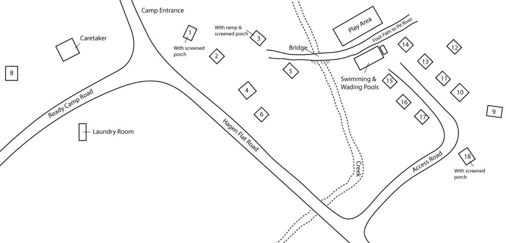
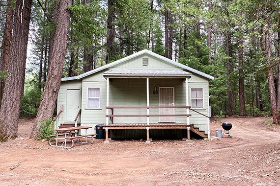
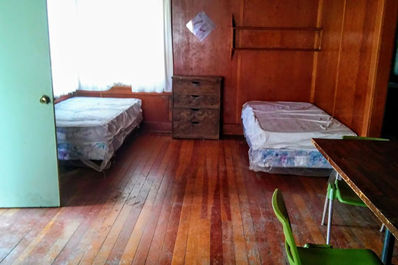
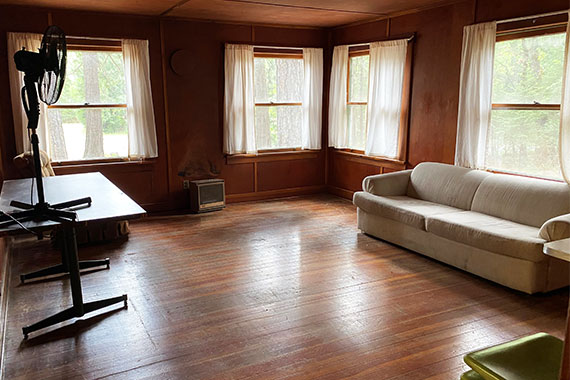
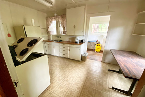
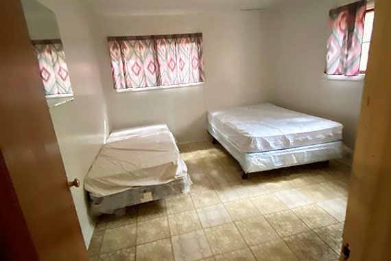
Cabin Information
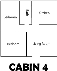
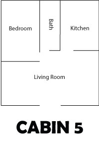
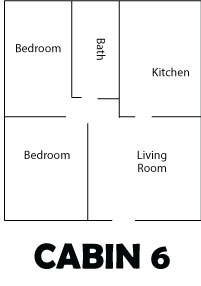
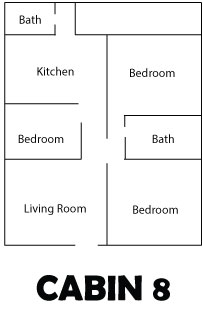
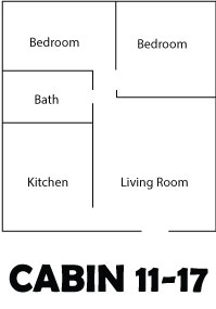
Seventeen Units – one (5 person), fourteen (6 person), two (eight person)
Each unit has the following:
- Table with chairs
- Beds (see chart to the right)
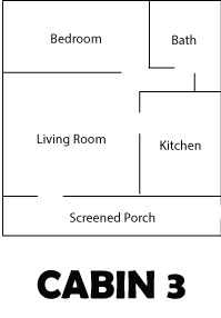
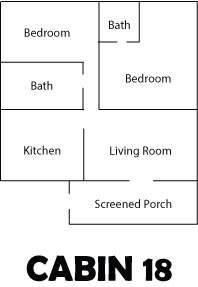
- One bathroom with shower (with the exception of cabins 8 and 18, which have two bathrooms with showers. The bathroom in cabin 3 includes a bathtub.)
- Fully equipped kitchen, which includes an electric range, refrigerator, microwave, coffee maker, toaster, cooking utensils, kitchenware (dishes, silverware, etc.)
Campers must bring their own toiletries and linens (sheets, pillowcases, pillows, blankets, and towels).
| CABIN | BED ROOMS |
BEDS |
| 1, 2, 11, 12, 13, 14, 15, 16, 17, 18 | Two | 1D, 4T |
| 3 | One | 1D, 3T |
| 4, 6 | Two | 1D, 4T |
| 5 | One | 1D, 4T |
| 8, 9 | Three | 1D, 6T |
| 10 | Three | 1D, 4T |
| D=Double Bed; T=Twin Bed | ||
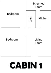
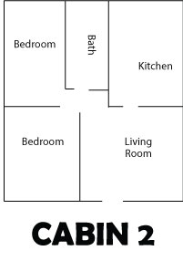
Cabin Floor Plans


Directions & Weather
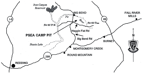
Camp Pit River is approximately 60 miles east of Redding near the Pit River and about three miles southeast of Big Bend. From Highway 299, turn left on Big Bend Road which is approximately four (4) miles from Montgomery Creek. Take Big Bend Road for approximately seventeen (17) miles, then turn right on Haggin Flat Road, and go 1.7 miles to Camp Pit River.
Camp Hosts
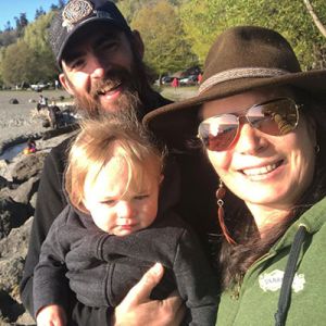
Sky Warrior and Roberta Romm
(530) 337-6530
Hagen Flat Rd
Big Bend, CA 96011
This will be Sky and Roberta’s first season at Camp Pit. We are happy to have on-site caretakers and can’t wait to see what they do for the camp.
Water Sports Advisory
Several water bodies in the southwestern United States, including California, have become infested with the non-native Quagga mussel in recent years. This species is very invasive and, once introduced, can proliferate rapidly. The spread of these mussels is very damaging to the native ecosystem and ultimately causes significant harm to water collection and distribution systems, including power generation facilities. Fortunately, they are not currently known to exist in any PG&E reservoirs. The biggest risk factor for the spread of this species is bringing watercraft or water-related equipment from infested waters. If you are planning to bring a boat or other water-borne equipment to a PSEA facility, find out more about how you can help prevent the spread of this species by going to the Department of Fish and Game website at https://wildlife.ca.gov/Conservation/Invasives/Quagga-Mussels.